
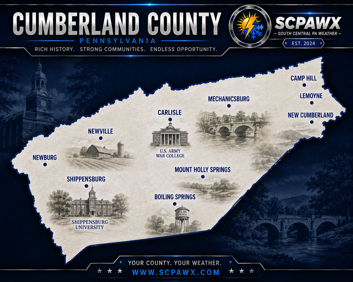
Forecast for Tuesday, October 13, 2026
TODAY
Well, here we are, nearly halfway through October, and Mother Nature apparently decided that the calendar is nothing more than a decorative suggestion. After spending the weekend getting soaked by the remnants of Isaias, we're now looking at temperatures that belong somewhere in late August rather than the middle of fall. Pennsylvania weather has never been particularly interested in behaving itself, and this week is shaping up to be another fine example of that nonsense.
Expect plenty of sunshine today from Carlisle and Mechanicsburg through Camp Hill, Enola, New Cumberland, Shippensburg, and the surrounding communities. Any lingering patchy fog or low clouds should give way to mostly sunny skies, allowing afternoon temperatures to climb into the lower 80s, generally around 80 to 82 degrees. A light southwest breeze will accompany the warmth, but nothing particularly troublesome is expected. If you've been waiting for a decent opportunity to get outside after Sunday's soaking, today is going to be a pretty good one.
Of course, all that sunshine doesn't mean the ground has suddenly forgotten how much rain fell over the weekend. Carlisle reported 3.75 inches from the storm, while other locations around Mount Holly Springs, Shippensburg, and the western portions of the county also picked up several inches. Fields, yards, trails, and other poorly drained locations may still be soggy, so don't be surprised if you discover that the ground has a slightly different opinion about how dry things are than the sky does. The atmosphere may have moved on, but the mud hasn't necessarily gotten the memo.
TONIGHT
Mostly clear skies will continue tonight, with temperatures only dropping into the lower to middle 60s by Wednesday morning. That's remarkably mild for the middle of October, especially considering we're getting close to the time of year when frost becomes a regular concern. Southwest winds should remain fairly light, and there are no significant weather problems expected overnight.
The usual colder spots around Mount Holly Springs, Boiling Springs, Newville, and the rural valleys west of Carlisle may cool a little more efficiently than the developed areas around Mechanicsburg and Camp Hill. Some localized fog could develop where the ground remains particularly wet, but widespread fog isn't expected to be a major issue. Otherwise, it's a comfortable evening to sit outside, open the windows, or enjoy the fact that the heating bill gets another night off. Just don't get too attached to it, because the weather is about to change its mind.
TOMORROW
Wednesday brings another round of unusually warm October weather, with partly to mostly sunny skies and afternoon temperatures climbing into the lower 80s. Carlisle, Mechanicsburg, Camp Hill, New Cumberland, and the surrounding lower elevations should have little difficulty reaching 80 degrees, while the higher terrain toward South Mountain may run a few degrees cooler. We're talking temperatures running roughly 10 to 15 degrees above average, which is a pretty impressive performance for a month that's supposed to be transitioning toward colder weather.
A weak cold front will approach and move through the region later Wednesday. There could be an isolated, brief shower somewhere across the area, but the overwhelming majority of locations should remain dry. This isn't shaping up to be a widespread rainfall event, and I wouldn't be rearranging outdoor plans over a shower that may never materialize in your particular backyard. Clouds may increase somewhat later in the day and Wednesday night as the front works through, with overnight temperatures settling into the middle 50s.
The important part of Wednesday's forecast isn't really the rain chance. It's that we're squeezing one more very warm day out of October before the atmosphere decides to start acting like it remembers what season we're actually in.
BOTTOM LINE
Thursday will bring a noticeable cooldown behind Wednesday's front, with partly sunny skies and afternoon temperatures generally in the middle 60s. That's a drop of roughly 15 degrees compared to Wednesday, and while it certainly won't be bitterly cold, it will feel a lot more appropriate for October. Most of the daytime hours should remain dry, although clouds will gradually increase as our next weather system approaches.
Thursday night into Friday is when things become more interesting. A stronger cold front will bring a better opportunity for showers, with rain becoming likely overnight and continuing into at least part of Friday. Current guidance suggests that the showers should gradually diminish during the afternoon, although we'll need to fine-tune that timing as the system gets closer. Friday's temperatures may climb into the lower 70s ahead of the front before colder air begins arriving, and some locations could actually see temperatures falling during the afternoon.
The bigger concern Friday may end up being the wind rather than the rain. As the stronger front moves through, northwest winds will increase, and gusts exceeding 40 mph are possible across central Pennsylvania. That doesn't automatically mean everyone will see winds that strong, but it's enough to warrant attention, particularly with trees still carrying a fair amount of foliage. Anyone with lightweight outdoor decorations, patio furniture, or anything else that likes to relocate itself during windy weather might want to make sure it's secured before Friday arrives.
Saturday looks dry and mostly sunny, but we're going to pay for those 80-degree temperatures earlier in the week. Afternoon highs will struggle to reach the middle 50s, and a brisk northwest breeze will make it feel considerably colder. Whether you're heading to the Carlisle area, spending time around Pine Grove Furnace State Park, hiking near Kings Gap, or enjoying the fall scenery around Mount Holly Springs, this will be jacket weather. The shorts and T-shirt routine from Tuesday and Wednesday probably isn't going to cut it unless you enjoy being unnecessarily miserable.
Saturday night into Sunday morning is when we need to pay particular attention to temperatures. Overnight lows are expected to fall into the middle 30s, with colder rural locations around Newville, Mount Holly Springs, Boiling Springs, and the valleys near South Mountain potentially getting closer to the freezing mark. Frost is becoming increasingly likely, and some of those sheltered valleys could experience freezing temperatures if skies remain clear and winds settle down. We're not issuing a blanket freeze declaration at this point, but anyone still hanging onto sensitive flowers, vegetables, or other plants should be thinking about protecting them.
Sunday itself looks like the better of the two weekend days for outdoor activities. Mostly sunny skies should return, winds will be lighter, and afternoon temperatures will recover into the upper 50s. It still won't be particularly warm, but compared to Saturday's breezy conditions, it should feel considerably more comfortable. Monday then brings another modest improvement, with sunshine and temperatures returning to the middle 60s as the colder air begins moving out.
Here's the ridiculous part of this entire forecast. We could be sitting around 82 degrees Wednesday afternoon, then waking up Sunday morning to temperatures near 35 degrees. That's almost a 50-degree swing in just a few days. One minute you're considering turning the air conditioning back on, and the next you're wondering whether you remembered where you put the windshield scraper. Welcome to October in Pennsylvania, where the weather apparently has the attention span of a goldfish.
SCPAWX will continue watching Friday's stronger cold front, the potential for gusty winds, and the developing frost and freeze threat heading into Sunday morning. Confidence is good in the overall temperature swing and the arrival of colder weekend weather, but the exact wind speeds Friday and the coldest overnight temperatures will need some additional refinement as we get closer.
SCPAWX proudly recognizes Shay's Vending Service of Lebanon, Inc. and the Blue Bird Inn in Cornwall for their continued support of independent weather forecasting across South Central Pennsylvania.
SPONSORS

Forecast for Thursday May 14, 2026
TODAY: Partly sunny this morning, then becoming mostly cloudy because May saw your Carlisle Farmers Market plans and said “that’s cute.” Cooler with highs in the upper 50s — we’re still on probation for Wednesday’s felony. Northwest winds 10 to 15 mph with gusts up to 25 mph — that’s “blow the Army War College flag straight horizontal” and “yeet your Dickinson College brochure to Shippensburg” weather. It’s sweatshirt-in-May season again. If you’re on I-81, congrats, you’re now in a wind tunnel test. At least the potholes will air dry.
TONIGHT: Mostly cloudy. Lows in the upper 40s — cold enough that the War College cadets are questioning their life choices. Northwest winds 5 to 10 mph with gusts up to 25 mph — the wind’s still mad about Wednesday and your trash cans are about to learn the Blue Mountain tunnel route by heart. If your recycling bin ends up at the Fairgrounds, just call it a pre-registration. Secure anything not bolted down unless you want to file a missing persons report with PennDOT.
FRIDAY: Partly sunny. Warmer with highs in the lower 70s — the atmosphere’s parole paperwork finally cleared. Northwest winds 10 to 15 mph with gusts up to 25 mph — Mother Nature’s still slamming the door on her way out. Great day to walk the LeTort, hit the Carlisle Pike, or pretend Wednesday was a fever dream. Just don’t park under those downtown trees unless you want a free limb with your coffee. Mow now, because May’s reliability ends at 5pm.
FRIDAY NIGHT: Mostly cloudy in the evening, then clearing like the sky finally finished its AAR after Wednesday’s op. Lows in the upper 40s — back to blankets, because May thinks it’s still winter FTX. West winds around 5 mph in the evening, becoming light and variable — the wind finally stands down. Crack the windows if you want, but don’t come crying to me when your bedroom feels like the barracks in February.
SATURDAY: Mostly sunny. Highs in the upper 70s — the weather graduates basic training and actually shows up. Southwest winds 5 to 10 mph — light enough that your Sheetz cup won’t gain air superiority. Prime day for the Farmers Market, a drive on 11, or telling out-of-towners that yes, we have more than one traffic circle. You did the time Wednesday. Saturday’s the weekend pass.
Cumberland County Bottom Line: Thursday’s upper 50s + 25 mph gusts = I-81 wind advisory and “why did I put the hoodie away” day. Tonight’s 40s with more gusts = your patio umbrella’s about to enlist and deploy to Franklin County. Friday’s 70s with wind = decent, if you anchor your hat. Friday night finally retreats to calm and 40s. Saturday’s upper 70s and light wind = victory gardening weather. Layer today, tie down everything tonight, mow Friday, flex Saturday.